Cycling the Pratomagno, Part 2
- Mike
- Aug 28, 2022
- 3 min read
Updated: Apr 22, 2024

Consuma - Pelago - Tosi - Saltino/Vallombrosa - Monte Secchieta - Vallombrosa - Consuma
33 miles / 4,600 feet / 3.25 hours
As with the loop described in Part 1, this is another ride that is best done in one direction only (in this case anti-clockwise) in order to avoid having to make the long climb up to Consuma on the main road. It's not that this road (70 on the map below) is particularly dangerous and I see plenty of other cyclists on it, but it's just not very enjoyable with big trucks using it during the week and the endlessly annoying Italian motorbike crowd going full throttle on it at the weekend.

Leaving Consuma going west towards Pontassieve and Florence there’s a fast 7.5 mile descent that involves just one left turn off the main road as you exit Diacceto (signposted to Pelago) and continues until you’re through the village of Pelago and heading towards Paterno.

Then 4 miles of gently rolling hills with great views south across the Valdarno to the Chianti mountains will put you past Paterno and into the next village of Tosi where the climbing begins.
Cycling the Pratomagno Part 2 has only one long climb of about 10 miles and 3,200 feet which will take you all the way to the top of Monte Secchieta, one of the highest points of the Pratomagno situated at almost 5,000 feet of elevation. Monte Secchieta lies at the northwestern end of the Pratomagno ridge line.
The first part of the climb to the Saltino/Vallombrosa road is 3.7 miles with no more than 1,600 feet of climbing which works out to an average gradient of about 8%. It’s mostly through a forest so in the summer there’s some relief from the sun.
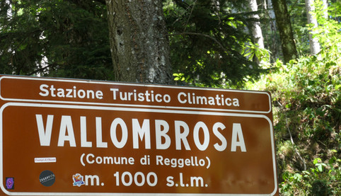
Towards the end as the road narrows you enter a one-way system which emerges at the Saltino to Vallombrosa road, about half-way between the two. Saltino is a very attractive old Victorian era resort town with various places to stop for refreshments, but to continue with the ride you turn left here and after few hundred yards of flat road you reach Vallombrosa.

Just before reaching the famous Vallombrosa Abbey there’s an uphill right turn signposted to Montemignaio which leads ultimately to Monte Secchieta; the turn here represents the half-way point of the climb. The second half is a little easier with the remaining 1,600 feet spread out over 5 miles resulting in an average gradient of 6% and the air up here is always pleasantly cool. This is an underused road with a good surface and only one turn to make at the signpost to Monte Secchieta.


The turning to Monte Secchieta is to the right with straight on being a descent into Montemignaio. From here the road surface isn't quite as good but still perfectly usable for a road bike. At the top of the climb just below the big white wind turbines there's a bar/casual lunch restaurant (above photo) that's reasonably well stocked.
You can also choose instead to drive up here and rent one of their electric bike models by the half day or longer. Their 2022 rates for up to 7 days are reproduced here.
Anywhere near Lucca this place would have been packed with cyclists at lunchtime but even in early August it was virtually deserted, probably because there is just so much choice of bike routes in the Pratomagno and Casentino.
To continue on farther you'll need a mountain bike because from this point the road becomes a strada bianca/dirt path and heads south-east along the ridge line to the highest point at La Croce di Pratomagno. I start to envy the mountain biker here because, as can be seen from the view below looking back towards Monte Secchieta, the ridge line looks like a fabulous ride with continuous panoramic views on both sides.

The alternative route back to Consuma which avoids Monte Secchieta but involves some additional climbing from Montemignaio to Consuma is to go straight on at the junction. This is another route I take from time to time because Montemignaio is an attractive and interesting small town, very popular also with hikers.

Staying on the original itinerary mapped out above, after Monte Secchieta you retrace your steps 5 miles back to Vallombrosa (specifically to avoid any further climbing) and turn right at the pond by the Abbey in the photo below.
This is signposted to Consuma which is no more than another 5 miles, making for a pleasant finish to the ride through the cool forest with only gentle undulations along the newly paved road. It connects to the main road only a few hundred yards before the entrance to Consuma so this is a great route for cyclists wishing to avoid traffic.


