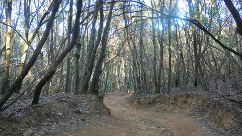
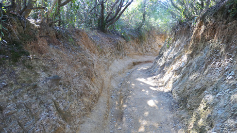
Via dei Cavalleggeri, Tuscany
- Mike
- Apr 2, 2022
- 3 min read
Updated: Dec 1, 2025


If anyone is still in need of a reason to visit Tuscany in late January or February when the skies are generally clear and the afternoon temperatures can often be pleasantly warm, then the photographs of this deserted coastal walk in the Maremma should do the trick.
This is the best time of year for hiking and the Lucca Aqueduct walk was documented and photographed last year during this same part of the year. Sixty degrees and sunshine is the perfect weather for hiking and you will have the trails all to yourself.

The Via dei Cavalleggeri is in the Maremma on a completely undeveloped part of the coastline between Populonia and Piombino, a 90 minute drive south of Lucca. It’s one of those trails that is just the right length for an out and back hike and, though not particularly challenging, there are enough ups and downs and overall length to make it very enjoyable for a reasonably fit 65 year old, me in other words.

There’s more than one trail here and they all start at the Calamoresca car park which is on the far western part of Piombino directly opposite the northern tip of the island of Elba. On entering Piombino from the east you first follow signs to Salivoli which avoids the downtown area of Piombino itself and from there Calamoresca is signposted.
After parking the car the first order of business is, as ever in Italy, to grab a coffee and pastry at the open air coffee shop and take in the views of Elba to the south as well as the small island of Capraia directly west and beyond that the mountains of Corsica.

As you will see from the large information board there are two main north-south paths: #302 which is the coastal route called Via dei Cavalleggeri and #300 which is the interior route called Via del Crinale. Being the interior route Crinale obviously has more elevation changes. You can choose to do some of both as we did and there are connecting paths between the two at various points, the most useful ones being #303 and #301.

Be aware though that when you’re out on the trails you will come across lots of well-used paths that are lacking signs and though all of them ultimately lead to one of the official paths you can eat up a lot of time taking any of these diversions. In the shorter winter days it pays to keep an eye on the clock because this is not an ideal place to find yourself in after dark. And in fact the solitary other person we met on the hike remarked that a few wolves had recently re-established themselves here.
For most people the 2.25 hour hike to the cove at Buca delle Fate is long enough for the outward leg, at which point you can link to the Via del Crinale. We chose to mostly stay on the Via dei Cavalleggeri but also spent some time on the 303 until we got to within sight of the fort in Populonia (below).

We took a couple of the unmarked trails that were well trodden and as long as you keep in mind where the sea is you'll always know in which direction you’re headed. Being sandwiched between trails 302 and 300 means that it should be hard to get really lost and eventually you'll come across one of these two marked trails. Plan to take your lunch and sufficient water with you because there are no facilities of any kind between Piombino and Populonia.


